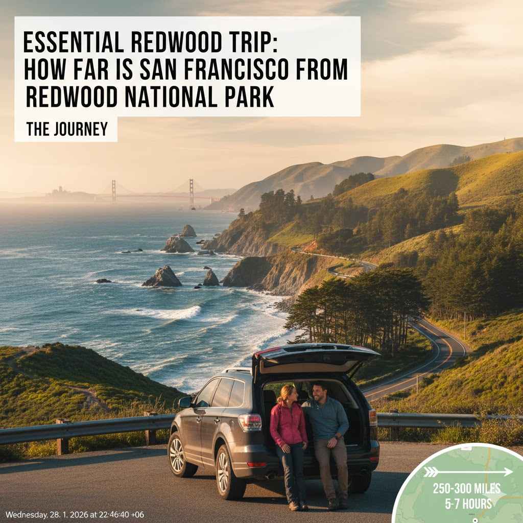
Essential Redwood Trip: How Far Is San Francisco From Redwood National Park
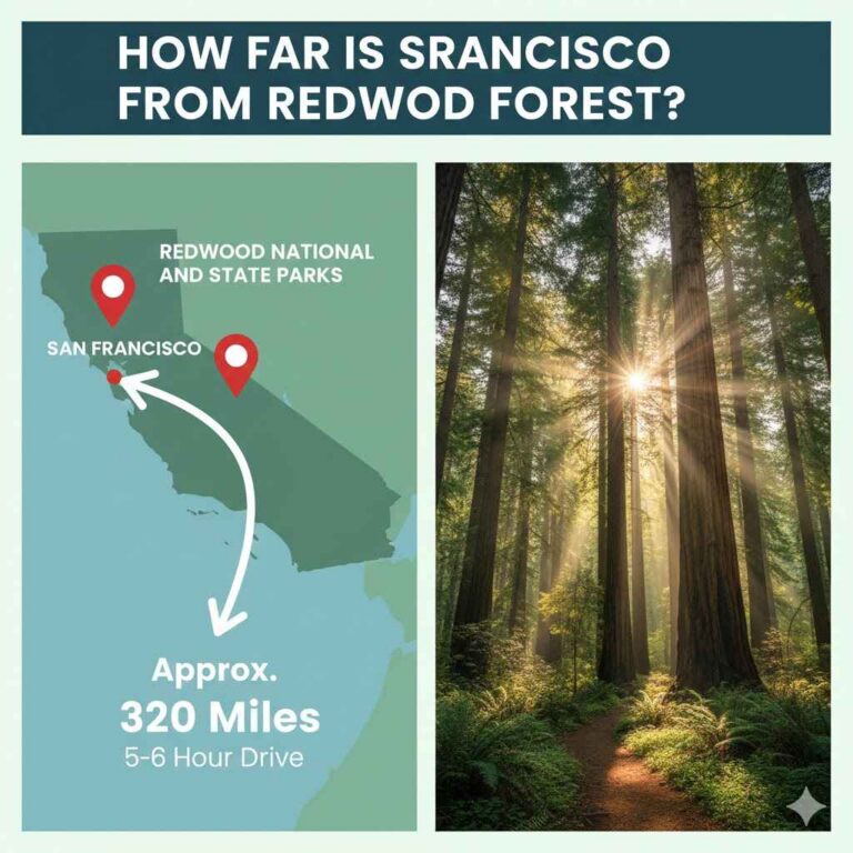
The driving distance from San Francisco to Redwood National and State Parks is roughly 300 to 330 miles, taking about 6 to 8 hours of focused driving time, depending on your exact destination within the park and traffic conditions. Plan for a solid travel day!
Planning a trip to see those towering giants, the coast redwoods, is an exciting venture! Many folks start their California adventure in the bustling city of San Francisco. You might look at a map and think, “That can’t be too far,” but driving to Redwood National and State Parks (RNSP) is more than just measuring miles. It’s about the road quality, the speed limits, and knowing where you are actually trying to end up within that huge park system. It’s common to feel a little uncertain about the logistics, but don’t worry!
I’ll break down the drive simply, step-by-step, so you feel completely prepared, just like when you check your measurements before making that perfect cut. We will cover the best routes, the time commitment, and the essential stops you won’t want to miss along the way. Let’s get you on the road to the biggest trees on Earth!
Understanding the Journey: San Francisco to Redwood National Park
When you are planning a major road trip, knowing the actual distance is just the starting point. Think of this like planning a big cabinet build—you need the cut list, but you also need to know how long it will take to get the wood from the lumberyard to your shop! The same applies here. Redwood National and State Parks aren’t one single spot; they stretch along the northern California coast.
The Core Numbers: Distance and Time
The driving distance varies slightly depending on exactly where in the park complex you are aiming for. The main visitor centers and key driving routes form the backbone of the planning process.
For the most common route, driving from the Golden Gate Bridge area in San Francisco to the southern gateway of the park system near Orick, California, you are looking at:
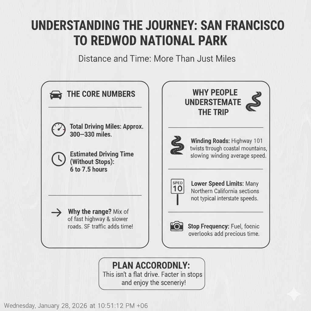
- Total Driving Miles: Approximately 300–330 miles.
- Estimated Driving Time (Without Stops): 6 to 7.5 hours.
Why such a big range in time? Well, Highway 101, the main artery for this trip, is a mix of fast interstate-style driving and slower, winding coastal roads, especially as you get further north of the Bay Area. Traffic exiting San Francisco can easily add an hour onto your start time!
Why People Underestimate the Trip
It is easy to look at a distance under 350 miles and assume it’s a quick six-hour cruise. However, this drive is different from crossing a flat state like Kansas.
- Winding Roads: Once you pass areas like Santa Rosa, the highway becomes much twistier as it climbs into the coastal mountains. This slows your average speed significantly.
- Speed Limits: Many sections of Highway 101 in Northern California have lower speed limits than typical interstate driving.
- Stop Frequency: This trip begs for stops! You’ll want to pause for fuel, food, and just to gaze at the increasingly rugged scenery. Each stop adds precious time.
Choosing Your Route: Highway 101 vs. Highway 1
As a DIYer, you know that choosing the right tool for the job makes all the difference. The same principle applies to road choice—picking the right highway dictates your travel experience. For reaching the redwoods, you have two main contenders: US Highway 101 and the legendary California State Route 1 (Pacific Coast Highway).
Option 1: The Fastest Path – US Highway 101 (The Recommended Route)
For most visitors focused on getting to the big trees efficiently, Highway 101 is your champion.
Highway 101 travels slightly inland through California’s interior valleys before connecting back to the coast near the park entrance. It’s generally the quickest and most direct way to cover the 300+ miles.
Pros of Taking Highway 101:
- Speed: Higher sustained speed limits are more common here.
- Reliability: It is less prone to sudden closures due to landslides, a frequent issue on Highway 1.
- Access: It runs directly through or very near major towns like Santa Rosa, Ukiah, and Eureka, which are great spots for supplies.
Cons of Taking Highway 101:
- Less Coastal Scenery: You miss some of the dramatic ocean cliffs found closer to the water.
- Truck Traffic: Being a major commercial route, you may encounter more large trucks.
Option 2: The Scenic Detour – California State Route 1 (PCH)
If you have an extra day to spare and your priority is seeing the rugged, wild California coast—not just the redwoods—Highway 1 is tempting.
Be warned: Highway 1 and Highway 101 merge and separate frequently in Northern California. While beautiful, taking Highway 1 for the entire stretch from SF is not practical for reaching the park in one day.
Key Consideration for Highway 1:
Sections of Highway 1 north of San Francisco (especially around Big Sur, which is south of SF, but the northern sections can also be tricky) are frequently subject to closures or long delays due to seasonal weather. Always check the current status before deciding on this route. For a reliable trip to the Redwoods, stick to 101 for the majority of the journey.
Step-by-Step Driving Guide: San Francisco North
Let’s break down the drive on Highway 101 into manageable segments. Think of this like tackling a complex joinery project—break it down into simple, achievable steps.
Phase 1: Escaping the Bay Area (Mile 0 to 60)
This initial phase is often the slowest, but it’s crucial to navigate correctly.
- Get onto US-101 North: From anywhere in San Francisco, the goal is to find the on-ramp for 101 North heading toward the Golden Gate Bridge.
- Crossing the Bridge (Optional): If you start in the city proper, you must cross the Golden Gate Bridge (Toll applies heading North). If you start north of the city, you might skip this, but most visitors start south.
- Marin County & Wine Country: Once across, you’ll pass through Marin County and start heading into Sonoma and Napa Valleys. Keep it steady; speed traps are common here.
Phase 2: The Heart of Wine Country (Mile 60 to 140)
This stretch is relatively smooth sailing as you head toward the northern interior.
You will pass through Santa Rosa and Healdsburg. The road quality is usually good, and this is a perfect time to top off your fuel tank. Services are abundant here.
Pro Tip: This area has less cell service than the immediate Bay Area. Download your maps offline before leaving!
Phase 3: Into the Redwood Corridor (Mile 140 to 300+)
This is where the drive gets interesting and the landscape transforms dramatically. You will generally pass through towns like Ukiah, Willits, and then eventually hit Eureka or Arcata.
As you drive north from Willits, you are officially entering prime redwood territory. The highway starts to hug the coastal mountains more closely. While still 101, the driving becomes slower, requiring more focus.
Essential Pit Stop Strategy
Use the larger towns (Ukiah, Eureka) for major breaks. Smaller towns might have limited gas stations or higher prices.
Check Official Park Information: Before arriving, check the National Park Service website for the most up-to-date alerts regarding road closures or necessary permit/entry information for Redwood National and State Parks. Safety first!
Mapping Your Destination within the Parks
Redwood National and State Parks (RNSP) is a collection of state and national parks managed jointly. It’s not a single, fenced-in area. Therefore, “reaching Redwood National Park” means getting to one of its many access points.
Here is a quick guide comparing the driving time to three major visitor hubs from San Francisco (assuming ideal 101 driving):
| Destination Landmark | Approximate Miles from SF | Estimated Drive Time | What You’ll Find There |
|---|---|---|---|
| Avenue of the Giants (Southern End) | 260 miles | 5.5 – 6 hours | A stunning scenic alternative to 101; great first taste of the giants. |
| Orick / Prairie Creek Redwoods State Park | 310 miles | 6.5 – 7 hours | Home to Fern Canyon and excellent backpacking trailheads. A central hub. |
| Klamath / Redwood National Park Visitor Center | 330 miles | 7 – 8 hours | The northernmost visitor center; gateway to scenic drives like Howland Hill Road. |
See how the destination changes the travel time? If you aim for the Avenue of the Giants first, you shave off an hour compared to driving all the way to the Klamath area.
Fueling Up and Planning Stops: A Beginner’s Guide
If you’ve spent time working on projects, you know that running out of supplies halfway through is a nightmare. The same applies to road trips through remote areas. You need a solid fuel and rest plan.
When and Where to Fill Up
As you drive north on 101, gas stations are plentiful until you pass Eureka. After Eureka, services become much more spread out, especially if you veer onto scenic side roads.
Fueling Checklist:
- Fill your tank completely in Santa Rosa or Ukiah. These are the last major cities with many affordable options.
- Aim to refuel again in Eureka or Arcata—these are the last moderately sized towns before the deep park areas.
- Never let your tank drop below half full once north of Eureka.
Recommended Breaks for Stretching and Supplies
To keep fatigue low (which is vital for safe driving on winding roads), plan for a substantial break every 2.5 to 3 hours.
| Recommended Stop | Location Type | What to Do |
|---|---|---|
| Healdsburg/Cloverdale | Town/Food | Quick lunch, coffee, restroom break. Good service access. |
| Ukiah | City/Services | Mid-trip refueling, stretch your legs, grab road snacks. |
| Eureka/Arcata | City/Services | Final major supply stop before entering the core park zone. Look at the historic waterfront in Eureka. |
Making the Most of the Scenic Routes Near the Park
Once you arrive in the vicinity of Redwood National and State Parks, the real adventure begins. The main Highway 101 often bypasses the best viewing areas. This is when you switch from highway driving to scenic driving—it’s like switching from a rough utility knife to a fine chisel!
The Avenue of the Giants (A Must-See Detour)
This 31-mile scenic alternative parallels Highway 101 south of the main park area. It used to be the old highway route, and because it avoids major commercial traffic, it is incredibly peaceful.
How to Access It: Look for the signs directing you off 101 near Myers Flat. It connects back to 101 near Pepperwood.
This drive is famous for drive-thru trees (a fun tourist stop!) and unparalleled access to some of the oldest groves. It will add about an hour to your drive time if you take your time enjoying it.
Newton B. Drury Parkway
This scenic alternative is located further north, near the town of Prairie Creek. It splits off from 101 and offers beautiful, easy-to-access groves right off the road.
It is a paved, two-lane road that allows you to soak in the atmosphere without worrying about heavy 101 traffic. If you plan on visiting the famous Elk Prairie area, this parkway is the way to go.
Safety Considerations for Northern California Driving
As someone who values safety in the workshop, I urge you to apply the same caution to the road. Northern California, especially the far north, has unique driving hazards.
Fog and Coastal Conditions
Especially in the mornings or late afternoons near the coast, dense fog (often called “marine layer”) can roll in quickly, drastically reducing visibility. Drive slowly and always use your low-beam headlights, even if it doesn’t feel dark.
Wildlife Encounters
You are entering prime elk and deer territory. Roosevelt Elk are magnificent but large. They often graze right near the road, especially in the Prairie Creek area.
- Avoid driving at dawn or dusk if possible, as this is when wildlife is most active.
- Never feed or approach wildlife. Maintaining a safe distance ensures their safety and yours.
Cell Service Gaps
This is the biggest planning difference between driving locally and driving to the Redwoods. Once you pass the populated areas like Eureka, cell service becomes spotty to nonexistent. This isn’t just annoying; it’s a safety issue.
Essential Digital Prep (Toolbox Analogy): Treat offline maps like pre-measuring your lumber—you must do it beforehand!
- Use Google Maps or Waze to download the entire region of Northern California (from Cloverdale north) for offline navigation before you leave the Bay Area.
- Have physical maps or printouts of your first campsite or hotel reservation address.
For official guidance on park access and safety, the California Department of Transportation (Caltrans) website is the best source for checking real-time road conditions for potential closures before you leave the city.
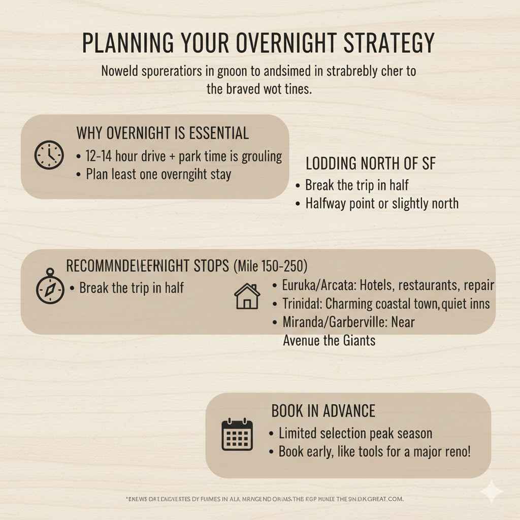
Planning Your Overnight Strategy
Can you drive from San Francisco to the Redwoods and back in one day? Technically, yes. Should you? Absolutely not. Driving 12–14 hours plus park time turns a beautiful nature trip into a grueling chore.
To truly enjoy the scale of these trees, plan for at least one overnight stay near the park boundaries.
Lodging North of SF
Most first-time visitors find it best to break the trip in half, lodging somewhere around the halfway point or slightly north of it.
Recommended Overnight Stops (Around Mile 150–250):
- Eureka/Arcata: These are the largest metropolitan areas near the park, offering the widest selection of hotels, restaurants, and repair shops if you need any last-minute vehicle attention.
- Trinidad: A beautiful, small coastal town just north of Arcata, offering charming inns and a true seaside feel. Great if you prefer quiet over city amenities.
- Miranda/Garberville: These towns are situated right near the Avenue of the Giants, putting you closer to the southern trails for an early start the next morning.
When booking accommodation near the parks, remember that selection can be limited, especially during peak summer weekends. Book well in advance, just as you would secure specialized tools for a major renovation!
Frequently Asked Questions (FAQ) for Redwood First-Timers
Here are some quick answers to common questions about making this journey.
Q1: Is it safe to drive to Redwood National Park alone?
A: Yes, driving Highway 101 is generally safe. The biggest risks are fatigue and reduced visibility from fog. Stay aware, take breaks, and never rely solely on your phone for navigation in remote stretches.
Q2: Do I need a 4×4 vehicle to drive to the main Redwood areas?
A: No. For the primary viewing areas like the main visitor centers, scenic drives (Avenue of the Giants, Drury Parkway), and standard campgrounds accessed from Highway 101, a standard car or SUV is perfectly fine, provided the roads are dry.
Q3: Is there any cost involved besides gas?
A: Yes. While driving through the areas on Highway 101 is free, specific, popular scenic drives (like the Avenue of the Giants or Howland Hill Road) may have small, optional day-use fees, and there are fees for camping or entering certain preserved State Park groves.
Q4: How can I shave time off the 7-hour drive?
A: The only real way to shave significant time is by leaving San Francisco before 7:00 AM to avoid city traffic, and by sticking strictly to US Highway 101 without taking any scenic detours on the way up.
Q5: When is the best time of year to make the drive?
A: Late spring (May/June) and early fall (September/October) usually offer the best combination of manageable crowds, clearer skies inland, and manageable coastal fog, making the drive safer and more enjoyable.
Q6: Are there places to see giant trees right off Highway 101?
A: Yes, but for the truly immersive, up-close experience, you will need to exit the 101 onto dedicated scenic parkways like the Avenue of the Giants. The 101 is the conduit, but the scenic routes are where the magic happens.
Conclusion: Your Confidence-Boosting Travel Plan
Taking the leap from dreaming about the ancient redwood giants to actually planning the drive is exciting. I know seeing a distance like 330 miles can seem daunting, especially when you are used to shorter trips around the city. But remember the core principle: preparation prevents poor performance, whether you are laying down a perfect miter joint or navigating the Pacific coast!
By choosing the reliable US Highway 101, planning for a solid 7-hour drive time (plus stops), and ensuring you have offline maps and a full tank of gas north of Eureka, you have taken the guesswork out of the equation. This isn’t a sprint; it’s a beautiful transition from the urban environment to some of the oldest, most awe-inspiring natural structures on our planet. You have the knowledge now to make the drive smooth, safe, and enjoyable. Pack your snacks, check your tires, and get ready to witness true giants—you’ve got this!